
East / Space Coast community profile
Cocoa Village.
Historic riverfront character and a walkable cultural center.
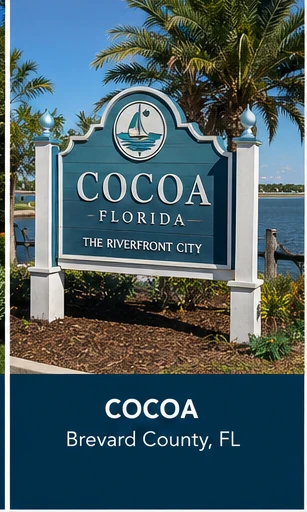
Cocoa Village is the historic riverfront core of the city of Cocoa, on Brevard County’s mainland along the Indian River, roughly 45 miles east of Orlando. It sits between State Road 520 and State Road 528, and it is connected by causeway to Merritt Island, Cape Canaveral, and Cocoa Beach — the barrier-island and launch-complex side of the Space Coast that Cocoa Village itself is not part of, but sits closest to on the mainland.
Who may thrive here
People drawn to a small, walkable historic downtown with genuine riverfront character, who want Space Coast access — beaches, launches, Port Canaveral — without living on the barrier island itself.
Community character
Cocoa Village’s brick streets and early-20th-century storefronts sit directly on the Indian River, with a working marina, small shops, and a downtown scaled for walking rather than driving. It is older and denser than the newer Brevard master-planned communities inland, with a genuine small-town waterfront feel rather than a planned one.
Transportation and access
U.S. 1 runs along the west side of the district and is the main north–south spine connecting Cocoa Village to Rockledge immediately south and Titusville to the north; SR 520 and SR 528 frame the district and lead west toward the Orlando metro and Kennedy Space Center’s visitor complex respectively. Causeways across the Indian and Banana Rivers connect Cocoa Village to Merritt Island and on to Cocoa Beach and Cape Canaveral, putting Atlantic beaches within a short drive despite Cocoa Village itself being on the mainland. Orlando is roughly an hour away via SR 528, the Beachline Expressway, which is the primary connector between the Space Coast and Orlando International Airport and the rest of Central Florida. I-95 runs a few miles inland and is the faster option for longer regional trips.
Schools, healthcare, and daily systems
- Commute at actual travel times
- Flood, insurance, and storm considerations
- Current school assignment boundaries
- Healthcare network access
- HOA or community development structures
- Planned roads and nearby construction
- Daily shopping and services
- Recreation and social connection
Potential tradeoffs
The historic downtown’s charm comes with the constraints of an older, denser district — smaller lots, older housing stock, and less new-construction inventory than Brevard’s planned communities further inland like Viera. Being close to the water means flood and wind insurance considerations should be investigated carefully for any specific address.
Mary’s perspective
The natural comparison is Cocoa Village against Rockledge, its immediate neighbor to the south: Rockledge is calmer and more residential, while Cocoa Village has the walkable downtown and riverfront activity. What a map won’t tell you is how much daily life here still runs on causeway timing — getting to the beach or to Port Canaveral means crossing water, and that crossing can back up during high-traffic events like a launch viewing. Before choosing it, worth investigating: flood zone and insurance costs for the specific street, since they vary meaningfully within a few blocks of the river, and how launch-related road closures on the causeways might affect a specific commute pattern.
Official resources
Verify school assignments, public services, infrastructure projects, insurance considerations, and property-specific requirements with the responsible agency or licensed professional.